Industrial Area
Dighi Port, Maharashtra
55 kms east of Dighi port
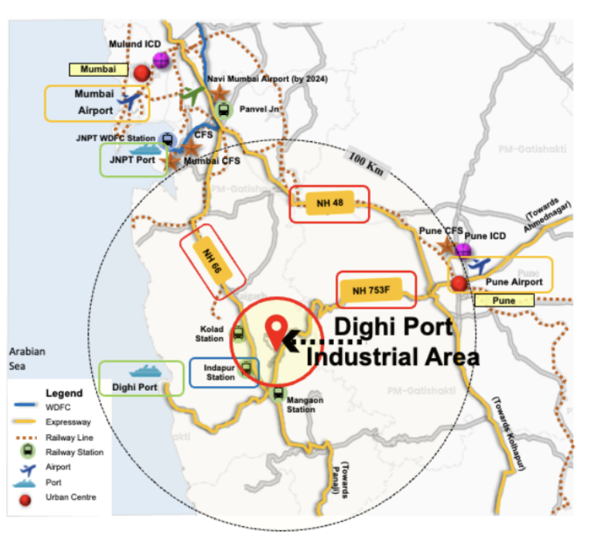
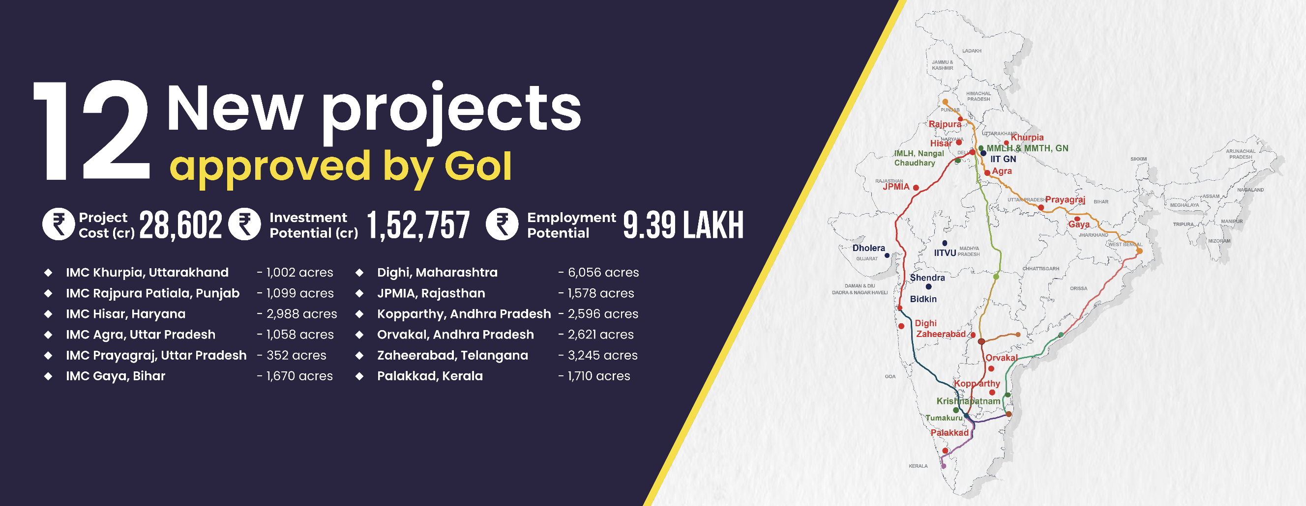
Dighi Port Industrial Area (DPIA), located in Raigad District, Maharashtra, spans 6,056 acres and is strategically situated near Dighi Port, enhancing its connectivity. The site offers access to NH-66 (10km) and is well-connected via rail to key industrial regions like Kolad, Roha, Raigad and Mangaon. The presence of the Konkan railway enhances the multimodal connectivity to the Dedicated Freight Corridor (DFC) and the Jawaharlal Nehru Port. DPIA aims to attract investments of ₹38,000 crore and create over 1 lakh jobs.
Project Overview
Project Area
6,056
acre
Project Cost
5,469
crore
Investment Potential
38,000
crore
Employment Potential
1,14,183
jobs
Key Benefits
Port led industrialization
Planned as a Port city to leverage upcoming Dighi port
To decongest Mumbai metropolitan area
Connected to both Mumbai & Pune
Eco tourism & Heritage tourism
Connectivity

Transport Network
| Name | Distance |
|---|---|
| NH 753F Mangaon-Pune | Adjacent |
| NH 66 | Mumbai - Goa | 10 kms from Project site |
| State Highway 97 | 1 km |
| Name | Distance |
|---|---|
| Kolad | 5 km |
| Indapur | 10 km |
| Mangaon | 10 km |
| Name | Distance |
|---|---|
| Mumbai Airport | 170 km |
| Navi Mumbai (Under Construction) | 120 km |
| Pune Airport | 116 km |
| Name | Distance |
|---|---|
| JNPT | 104 km |
| Mumbai Port | 153 km |
| Dighi Port | 55 km |
| Name | Distance |
|---|---|
| Proposed (to be developed by NHLML, RVNL and State Govt) | 15 Km |
Land-use Plan

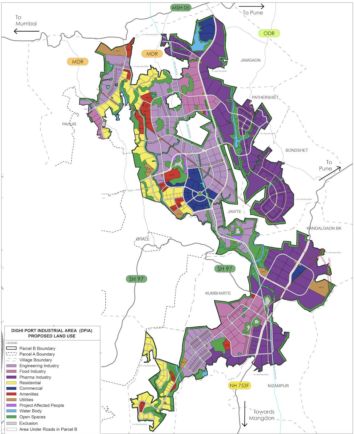
Area (acre) Distribution
| Land-use | Area | Area (%) |
|---|---|---|
| Industrial | 3005.22 | 49.62% |
| Residential | 496.03 | 8.19% |
| Commercial | 213.75 | 3.53% |
| Amenities | 178.59 | 2.95% |
| Open space | 1149.18 | 18.98% |
| Utilities | 117.14 | 1.93% |
| Roads | 676.58 | 11.17% |
| Waterbodies | 185.03 | 3.06% |
| PAPs* | 31.98 | 0.53% |
| Town Hall | 2.63 | 0.04% |
| Total | 6056.13 | 100% |
Focus Sectors
Engineering
Pharmaceuticals
Chemical
Textiles
Food & Beverages

