Industrial Area
Zaheerabad, Telangana
9 km north of Zaheerabad Town
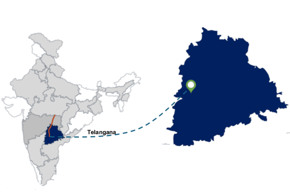
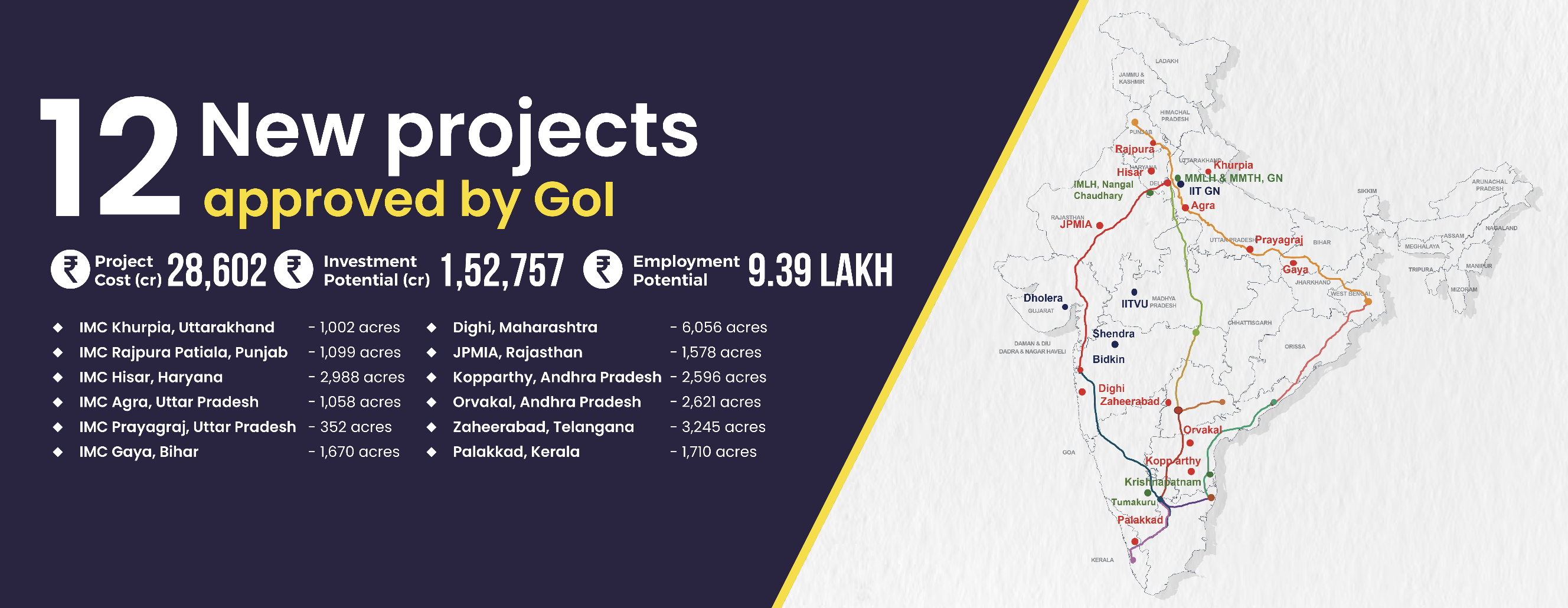
The Zaheerabad Industrial Node, spanning 12,635 acres across 17 villages in Sangareddy District, Telangana, is part of the Hyderabad-Nagpur Industrial Corridor. Located 9 km north of Zaheerabad, 80 km from Hyderabad, and close to NH-65, it offers excellent connectivity to major road networks, including the Hyderabad Outer Ring Road and the proposed Regional Ring Road. With a Phase 1 spanning 3,245 acres, the project aims to attract significant investments and drive industrial growth in the region, boosting Telangana’s economic landscape.
Project Overview
Project Area
3,245
acre
Project Cost
2,361
crore
Investment Potential
10,000
crore
Employment Potential
1,74,000
jobs
Key Benefits
Proximity to Hyderabad and NH-65 (Pune – Machilipatnam)
To act as counter-magnet to Hyderabad
Connectivity

Transport Network
| Name | Distance |
|---|---|
| NH 65 (Pune – Machilipatnam) With an under-construction 4 lane greenfield road | 9 km |
| SH 14 (Bidar – Zaheerabad) | 5 km |
| SH 16 (Nizampet - Bidar) | 1.5 km |
| Name | Distance |
|---|---|
| Metalkunta | 12 km |
| Zaheerabad | 19 km |
| Vikarabad | 76 km |
| Name | Distance |
|---|---|
| Rajiv Gandhi International Airport | 125 km |
| Bidar Domestic Airport | 20 km |
| Name | Distance |
|---|---|
| Machilipatnam (Proposed) | 485 km |
| Krishnapatnam | 620 km |
| Nhava Sheva (JNPT) | 600 km |
| Name | Distance |
|---|---|
| ICD Santnagar (Rail based) | 108 km |
| CFS Kukatpally (Road based) | 104 km |
| CFS Patancheruvu (Road based) | 81 km |
Land-use Plan
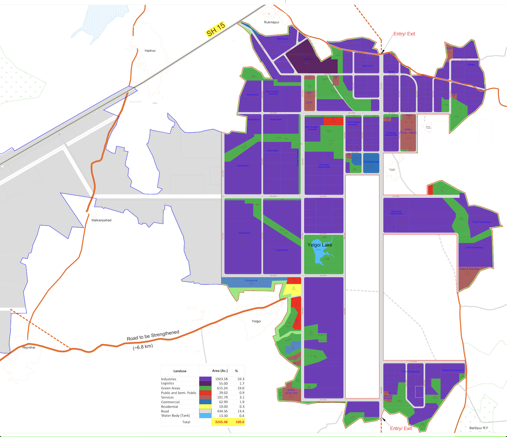
Area (acre) Distribution
| Land-use | Area | Area (%) |
|---|---|---|
| Industrial & Logistics | 1978.58 | 60.96% |
| Commercial | 62.99 | 1.94% |
| Residential | 10.00 | 0.31% |
| Amenities | 29.02 | 0.89% |
| Utilities | 101.79 | 3.14% |
| Green Area | 615.24 | 18.96% |
| Roads | 434.56 | 13.39% |
| Water body | 13.30 | 0.41% |
| Total | 3,245.48 | 100% |
Focus Sectors
Automobile
Transport equipment
Electrical equipment
Metals & non-metallic minerals
Food processing