Industrial Area
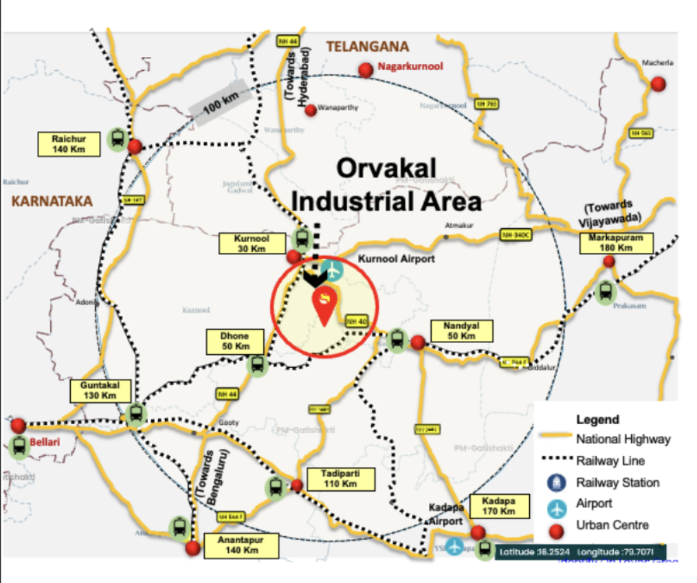
Orvakal, Andhra Pradesh
12 km from Kurnool Airport

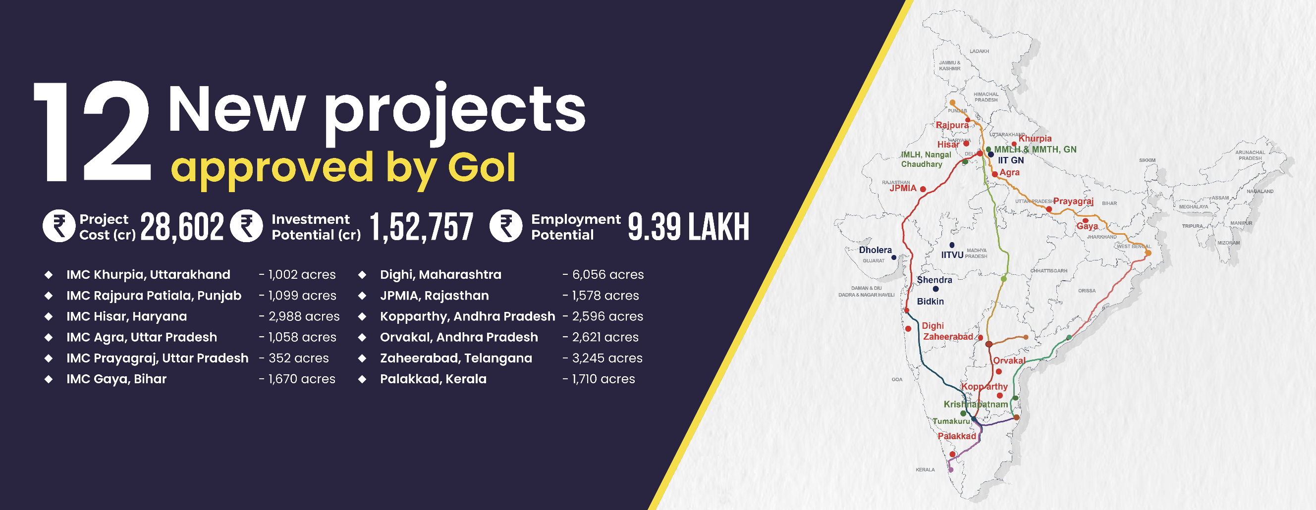
The Orvakal node in Kurnool District, spanning 2,621 acres, is being developed under the Hyderabad-Bengaluru Industrial Corridor. The site is strategically located with access to NH40, NH44, Kurnool Bypass, ensuring robust road connectivity. Kurnool Airport is nearby, and Krishnapatnam Port is 320 km east. With an investment potential of ₹12,000 crore and a project cost of ₹2,786 crore, Orvakal aims to generate 45,071 jobs. The node serves as a crucial link between the Chennai-Bangalore and Vishakhapatnam-Chennai Industrial Corridors. Environmental clearance has been secured, ensuring a sustainable development path.
Project Overview
Project Area
2,621
acre
Project Cost
2,786
crore
Investment Potential
12,000
crore
Employment Potential
45,071
jobs
Key Benefits
Boost economic activity in Rayalseema
To develop Kurnool as a regional industrial hub
3 hours from Hyderabad
Connectivity
Transport Network
| Name | Distance |
|---|---|
| NH-40 (Kurnool to Ranipet) | 4 km |
| NH-44 (Srinagar to Kanyakumari) | 28 km |
| NH-340C (Prakasam to Kurnool) | 26 km |
| MDR-180 (Hussainapuram to Uyyalawada) | crossing |
| Name | Distance |
|---|---|
| Kurnool | 35 km |
| Dupadu | 30 km |
| Veldurthi | 28 km |
| Betamcherla | 28 km |
| Name | Distance |
|---|---|
| Kurnool Airport | 12 km |
| Name | Distance |
|---|---|
| Krishnapatnam Port | 320 km |
| Kattupallli Port , Ponneri | 420 km |
| Name | Distance |
|---|---|
| Surareddypalem, Ongole | 270 km |
| Thimmapur, Rangareddy | 210 km |
Land-use Plan
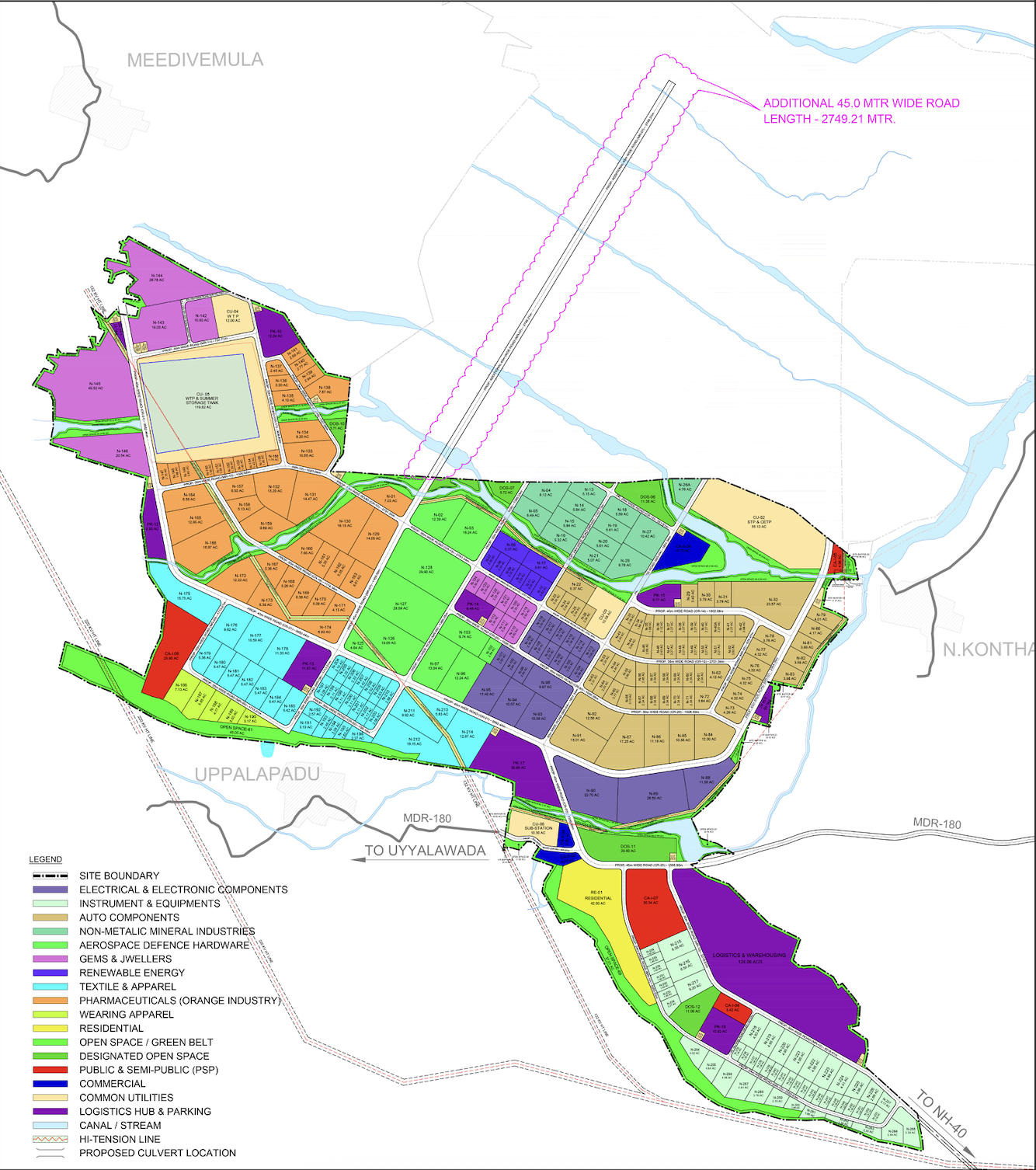
Area (acre) Distribution
| Land-use | Area | Area (%) |
|---|---|---|
| Industrial & Logistics | 1424 | 54% |
| Commercial | 18 | 1% |
| Residential | 42 | 2% |
| Institutional/Public Semi-Public | 64 | 2% |
| Logistics & Parking | 217 | 8% |
| Roads | 276 | 11% |
| Green & Waterbody | 363 | 14% |
| Utilities | 217 | 8% |
| Total | 2621 | 100% |
Focus Sectors
Non-Metallic minerals
Auto components
Aerospace & Defence Hardware
Pharmaceuticals
Renewables
Electrical & Electronic Components
Gems & Jewellery
Textile & Apparel